Geospatial#
Geospatial Projects
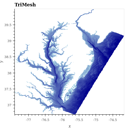
Visualizing water depth into the Chesapeake and Delaware Bays
Visualize 2010 Census demographic data
Interactive dashboard for making Datashader plots from any dataset that has latitude and longitude
Map of confirmed and candidate exoplanets by discovery date
Combine data of very different types to show gerrymandering
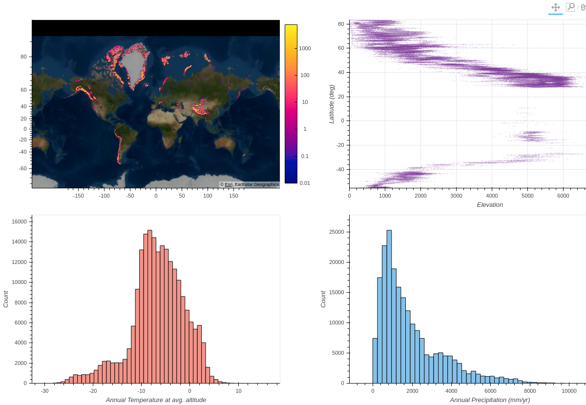
Glaciers explorer using Datashader and Panel
Visualizing GPS tracking for herring gulls in Belgium
Analysis of how trees affect heat distribution in urban areas. Based on a blog post by Ken Steif.
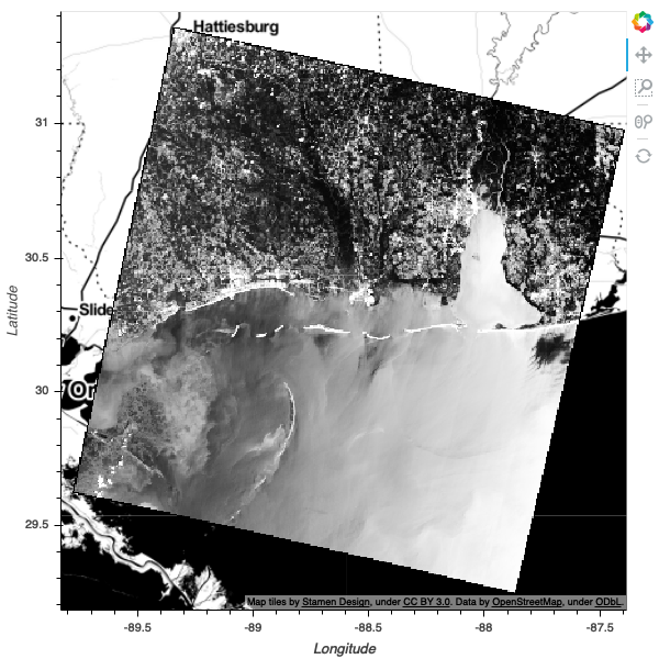
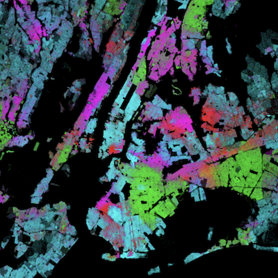
Datashading LandSat8 raster satellite imagery
Example of spectral clustering landsat data
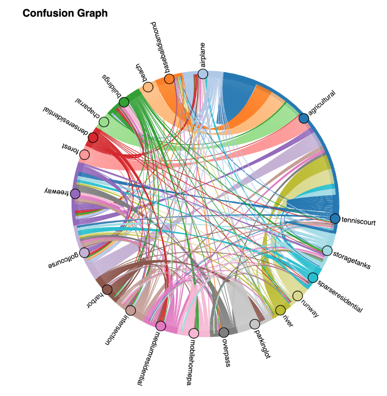
Image classification using the UC Merced Land Use Dataset
Using Bokeh/HoloViews/GeoViews for annotating data for ML
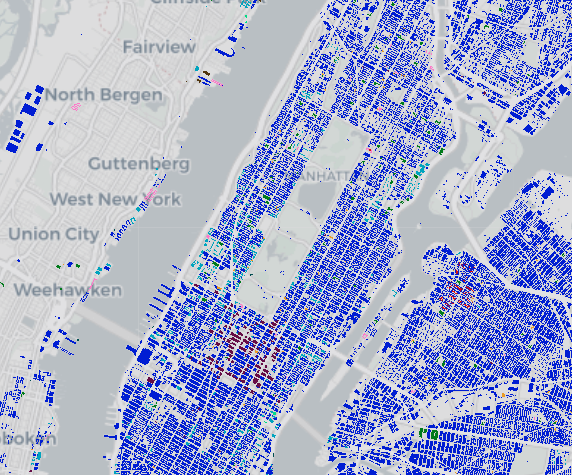
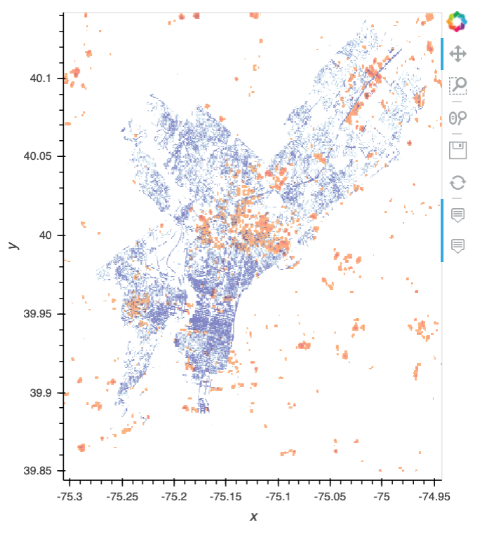
Visualize on a map all the buildings of New York City
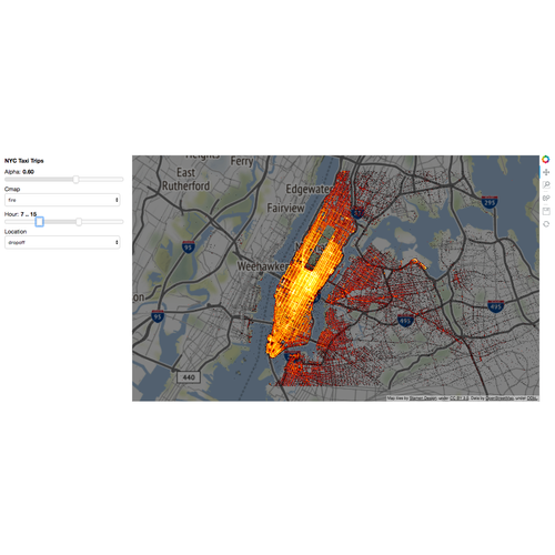
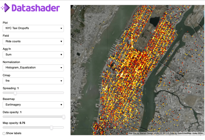
Plotting the NYC taxi dataset using Datashader.
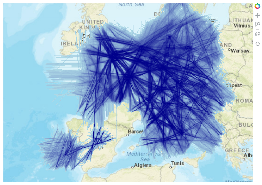
Datashading OpenSky flight trajectories
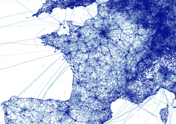
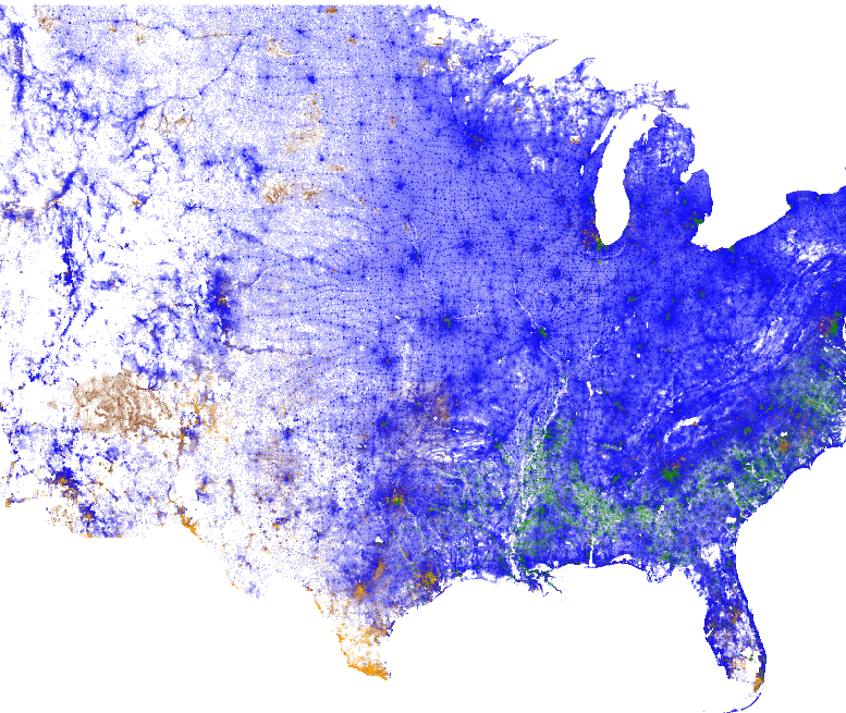
Datashading Open Street Map database
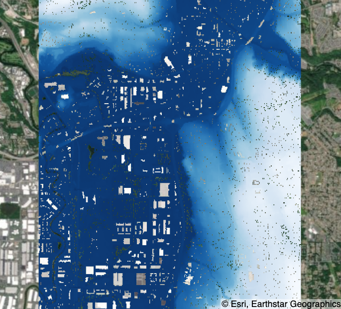
Visualize Lidar Scattered Point Elevation Data in Seattle
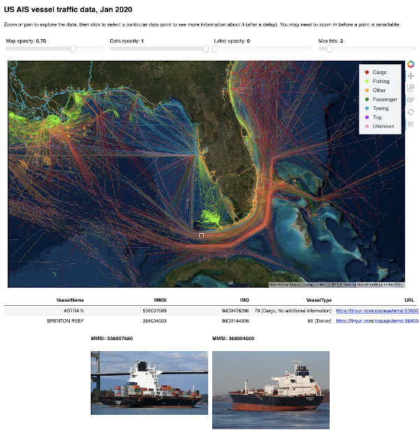
Visualizing AIS location tracking data for marine vessels near the USA
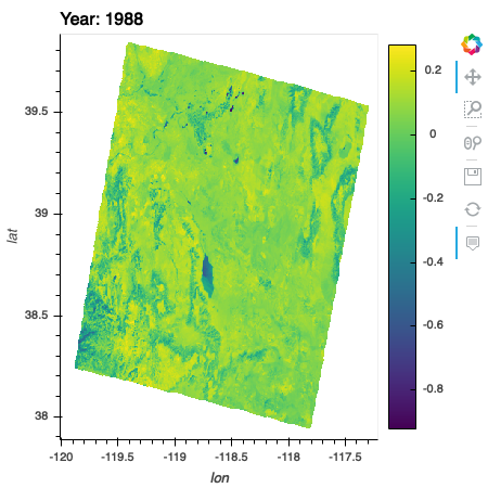
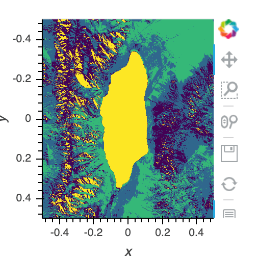
Analysis of NDVI over time of Walker Lake, Nevada